The delegation of the State Meteorological Agency (Aemet) in the Valencian Community has announced that this Saturday, in addition to the expected extreme heat, "violent phenomena" may occur with "very strong" gusts of wind or "warm blowouts" such as those produced in at dawn, when a strong gust of wind caused the collapse of the stage of the Medusa Festival in Cullera (Valencia) and caused one death and 17 injuries of varying degrees.
On this Saturday there is a red warning for the entire coast of the province of Valencia and the south of Alicante and also warnings for storms that can leave very strong gusts of wind.
As explained by Aemet, during the night there have been “warm outbursts” with gusts of “very strong wind and sudden rises in temperature”, probably of the so-called “convective”.
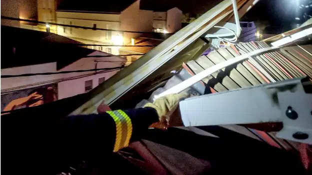
Firefighters carry out 60 night interventions
As a result of the gusts of wind, from 2:00 in the morning the firefighters have had up to 60 interventions due to strong winds throughout the province of Alicante related to falls or to avoid them, of trees, antennas, traffic signs, pergolas, awnings, etc. The areas most affected by the population in the south, especially in Santa Pola, Elche and Orihuela, according to the Alicante Provincial Consortium.
In a thread on Twitter, the Aemet agency explained that in the early hours of the night there were storms in Albacete and the Region of Murcia that were moving eastward, first reaching the Alicante coast at around 2.00:XNUMX a.m. and two hours later on From Valencia.
The storms had precipitation and some lightning in the interior but, as they approached the coast, the rain dissipated and there were hardly any lightning strikes. In fact, on the coast it has probably not rained or there have been moron showers.
Contrast of temperatures and humidity
Aemet details this phenomenon and why it occurs: the atmospheric profiles that give rise to hot bursts are "all very similar". "Its probes are said to be onion-shaped, with moist, relatively cool air next to the ground and an extremely dry, warm layer a few hundred meters above." In the case of the Alicante-Elche airport, after dawn, this phenomenon has exceeded 40 degrees and a gust of 80 km/h.
Damages for coming to Alcoy ALICANTE FIREFIGHTER CONSORTIUM
The other wet layer, which will be the base of the cloud, was "very high", at more than 5 kilometers in altitude, which was saturated between 5.800 and 6.500 meters of altitude. The base of the cloud was therefore very high and below it was a very dry layer more than four kilometers thick.
The precipitation that occurs at the base of the cloud, which is very high, evaporates in the lower lower layer; when evaporating the air cools down and becomes denser than the surroundings; as it becomes denser it begins to descend and accelerate.
The strong downdraft is produced mainly by the evaporation of water and the melting and sublimation of hail below the cloud base. For this reason, he explains, on the coast it has not rained or it has been very light, because the precipitation vaporized long before reaching the ground and that evaporation cooled the air, which is what descends and causes the blowout.
With the descending air, in that descent it "accelerates" and, if there is no thermal inversion, it hits the ground causing strong gusts, but the temperature does not rise. This is a dry blowout, which has occurred in Xàtiva, for example, with gusts of 84 km/h.
But if, on the other hand, there is inversion next to the ground (fresh and humid area), on its descent the air can pass through the fresh layer, causing the intrusion of warm air from above. In the zone where the zone of descent is due to the inversion, a sharp rise in temperature occurs and, of course, the theoretical model predicts temperatures of at least 40 degrees, as has happened.
Crossing the humid layer is in fact a "brake" for the air that descends from more than 5 km of altitude, but if the inversion is very shallow, as it was this morning, "the speed is sufficient to cross it and reach the ground with very strong speeds.
The blowouts have been widespread, in some cases there have been no strong gusts, because the inversion is very high and the air reaches the ground very slowly, in others the inversion has not broken but the temperature has risen due to the compression of the lowest stratum . In the most adverse cases, strong gusts of wind and sudden increases in temperature have occurred locally in some localities due to these hot bursts.